Holyrood Park Beyond Arthur’s Seat: Salisbury Crags and Every Route (2026)
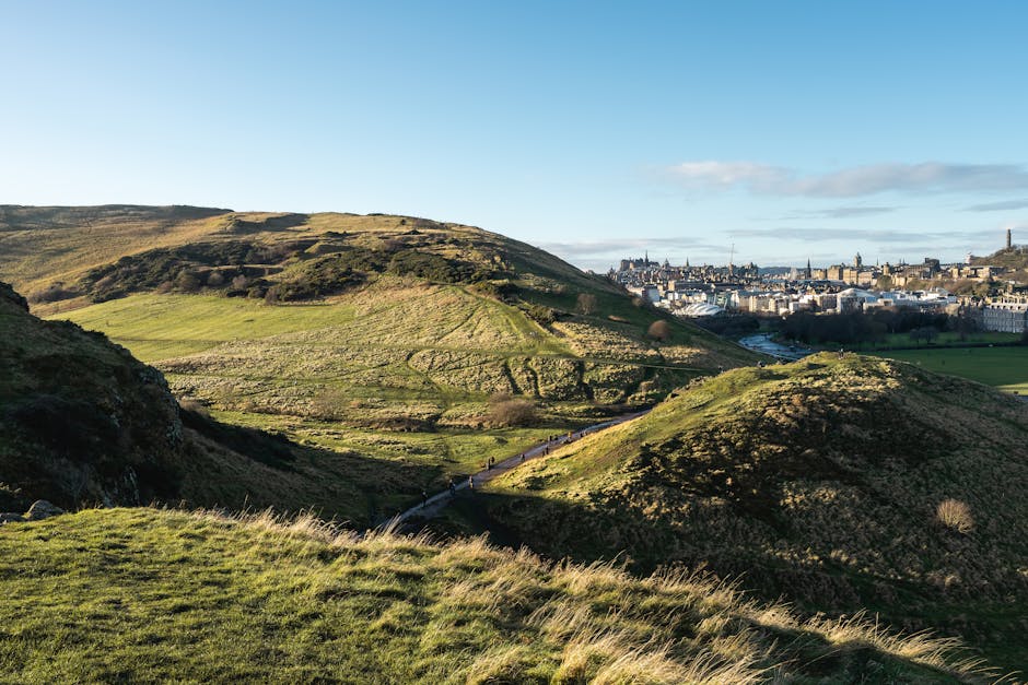
Most pages about Holyrood Park describe the Radical Road as though you can walk it. You cannot walk all of it, and you have not been able to since 2018, when a fifty-tonne rockfall closed the path that runs along the base of Salisbury Crags. The southern stretch, from the Hawse to the South Quarry, is open again; the northern section beneath the Crags is still fenced off, with no reopening date. Guides published this year still send readers along the whole thing. Blogs still recommend it as the easy alternative to the summit. It is the single biggest live inaccuracy in Edinburgh travel writing, and it matters because the Radical Road is the route that most non-summiteers would otherwise take.
Holyrood Park is far more than the hill. It is 650 acres of extinct volcano, three lochs, a ruined chapel, a hidden valley, ancient cultivation terraces and one of the most important sites in the history of geology, all inside a city. This guide covers the waymarked routes and the Salisbury Crags circular, says clearly what is open and what is not, and gives an honest assessment of which walk suits which kind of visitor. Status and route information below was checked in October 2026.
At a Glance
- The Radical Road closed in 2018 after a 50-tonne rockfall, and its northern section beneath Salisbury Crags is still fenced off with no reopening date. Built after the Radical War of 1820, it runs along the base of the Crags.
- The southern stretch has reopened. Historic Environment Scotland won consent on 27 May 2026 for planning application 25/06329/FUL, and the path from the Hawse to the South Quarry is open again, with Hutton’s Section. The northern section stays closed, and no date has been given for it.
- Why now: 2026 is the 300th anniversary of James Hutton’s birth, and Hutton’s Section — in the Crags — is where modern geology effectively begins.
- There are four waymarked routes through the park: red, blue, green and purple. Hardly any guide mentions them.
- The Salisbury Crags circular gives you the best view of the city for a fraction of the effort of the summit. Walk it on the path along the top of the Crags and the grassy slopes below, because the northern Radical Road under the cliff is still shut.
- The main summit route is about 2.5 miles and two hours, starting at the Broad Pavement near Holyrood Palace, passing St Anthony’s Chapel, with chain railings near the top. The summit is 251 metres.
- All park roads close to vehicles during the day on Saturdays and Sundays, with the times adjusted seasonally for daylight. This is the best time to walk here.
- Three lochs: St Margaret’s (below St Anthony’s Chapel), Dunsapie (high on the eastern side) and Duddingston (a nature reserve at the south-east corner).
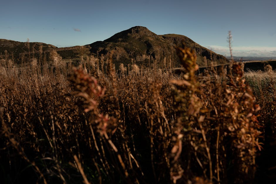
- Hunter’s Bog is the hidden valley between the Crags and the hill — flat, quiet, and the part of the park almost no visitor finds.
- Free, always open, no ticket, no booking. Managed by Historic Environment Scotland as a Property in Care.
Closures: What Is Actually Open in 2026
Read this section before you plan anything else, and then check it yourself, because this is the part of Holyrood Park that changes.
| Route or feature | Status when checked | Notes |
|---|---|---|
| Radical Road | Southern section open (the Hawse to the South Quarry, with Hutton’s Section); northern section closed since 2018 | HES consent for 25/06329/FUL granted 27 May 2026; no reopening date for the northern section |
| Hutton’s Section and Hutton’s Rock | Access restricted by the same closure | The proposed reopening is specifically to restore access to these |
| Arthur’s Seat summit routes | Open | All main ascents unaffected |
| Salisbury Crags upper path | Open | The path along the top of the Crags is not the Radical Road |
| Hunter’s Bog | Open | Flat valley route, unaffected |
| St Margaret’s and Dunsapie lochs | Open | Both on the Queen’s Drive circuit |
| St Anthony’s Chapel ruins | Open | Free, no barrier, above St Margaret’s Loch |
| Park roads | Closed to vehicles Saturdays and Sundays, daytime | Times vary with the season |
The Radical Road story, properly told
The path was built in the 1820s, after the Radical War of 1820, when unemployed weavers from the west of Scotland were set to work constructing it — hence the name. It runs along the foot of Salisbury Crags, directly beneath the cliff, and for two centuries it was the most-walked path in the park after the summit itself.
In 2018 a rockfall of around 50 tonnes came down onto it and Historic Environment Scotland closed it. It has been shut ever since — more than seven years — and for a period permanent closure was actively under consideration. Access campaigners including ScotWays and the Cockburn Association have argued that the right model is informed consent and clear risk communication rather than a blanket ban, pointing to paths such as the Grey Mare’s Tail and the Quiraing where rockfall risk is managed rather than fenced out.
The section from the Hawse to the South Quarry is now open again, Hutton’s Section included, after Historic Environment Scotland won consent on 27 May 2026. The approved scheme set out post-and-chain fencing — around 210 metres of it near Hutton’s Section — mesh panels over two metres high around South Quarry and Hutton’s Rock, vegetation management and interpretive signage warning of rockfall risk. The stated ambition was to have it open in time for the June 2026 tercentenary of James Hutton’s birth.
The honest verdict: the southern stretch is open and takes you to Hutton’s Section, but that is as far as you can go. The northern section beneath Salisbury Crags is closed and fenced off, and Historic Environment Scotland has given no date for reopening it. Plan a route that does not need the northern section, and do not set out to walk the Radical Road end to end. Do not trust a blog that describes walking the whole path — almost all of them are recycling pre-2018 copy.
The Four Colour-Coded Holyrood Park Walks
Historic Environment Scotland waymarks four routes through the park by colour. They are the most useful thing in Holyrood Park that visitors do not know about, because they solve the problem of a park with no obvious paths and a lot of desire lines.
| Route | Character | What you see | Best for |
|---|---|---|---|
| Red | Moderate; follows an ancient lava flow up to Arthur’s Seat | Views over Dunsapie Loch on the eastern side | The most interesting way to the summit |
| Blue | Gentle ascent through Hunter’s Bog | The hidden valley between the Crags and the hill | Quiet; the route almost nobody takes |
| Green | Shorter and easier, across grassy slopes | Ancient cultivation terraces on the hillside | Families, limited time, low effort |
| Purple | Direct and steeper, from Holyrood Park Road | Fastest height gain in the park | Fit walkers in a hurry |
The honest verdict: the green route is the answer for most people who do not want to summit and have been told to walk the Radical Road. It is short, it is genuinely easy, and the cultivation terraces — visible as faint horizontal ridges on the slope — are one of those things you cannot unsee once someone points them out. The blue route through Hunter’s Bog is the connoisseur’s choice: a flat, sheltered valley in the middle of a volcano, with the Crags on one side and the hill on the other, and on a weekday you will meet almost nobody.
The Salisbury Crags Circular: The Walk for People Who Do Not Want the Summit
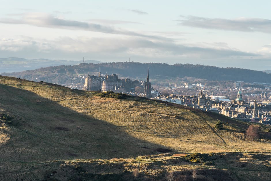
This is the walk that ought to be the default recommendation for visitors, and it is buried on page four of every list. A loop around Salisbury Crags, taking in the escarpment edge with the whole of the Old Town laid out below, and descending on lower grassy paths. It gives you perhaps 80% of the view from Arthur’s Seat for perhaps 40% of the effort.
The important caveat: the classic version of this circular uses part of the Radical Road along the base of the Crags. With the northern section still closed, the loop has to be walked on the upper path and the grassy slopes instead. That still works and it is still excellent — the view from the top edge of the Crags is better than the view from underneath them — but it means the route you find described online may not be the route you can actually walk.
The honest verdict: if you have an hour and a half, do this rather than the summit. The view from the Crags edge takes in the Castle, the Old Town spine, the New Town grid and the Forth, and you are looking at Edinburgh side-on rather than down on it, which is the more legible angle. The summit gives you a 360-degree panorama, a crowd, and wind.
The Summit Route, Briefly
Covered in full in our Arthur’s Seat hike guide, so here is only the shape of it. The standard ascent is about 2.5 miles and two hours round trip, starting from the Broad Pavement near the Palace of Holyroodhouse, climbing past the ruins of St Anthony’s Chapel, and finishing with a scramble beside metal chain railings onto the 251-metre summit. It is a hill walk, not a stroll, and the last section is genuinely steep.
The red route up the eastern flank, past Dunsapie Loch, is the better ascent if you have any choice — a gentler gradient on an old lava flow, far fewer people, and a much shorter final climb because you start higher. Almost every visitor goes up the front because that is where they are standing.
The Rest of the Park: What Else Is In Here
St Anthony’s Chapel
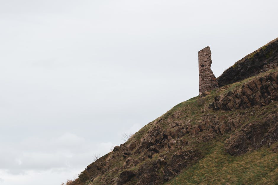
A roofless medieval ruin standing on a rock shelf above St Margaret’s Loch, free, unfenced and always accessible. Nobody knows for certain who built it or exactly when. It is a five-minute climb off the main path from the Palace end and it is the best short detour in the park — the view down over the loch and out towards the Forth is the postcard nobody sends.
St Margaret’s Loch
The shallow loch at the northern end of the park, on the Queen’s Drive, a few minutes’ walk from the Palace and the Parliament. Swans, geese and a great many people feeding them. It is the flattest, easiest part of the park and the right destination if you want ten minutes of green rather than a walk.
Dunsapie Loch
High on the eastern side, beside the Queen’s Drive, with a car park next to it. This is the secret of Arthur’s Seat: start here and most of the climbing is already done. On a weekend, when the park roads are shut to cars, you have to walk up to it — which is itself a pleasant route round the back of the hill and away from everyone.
Hunter’s Bog
The flat, boggy valley enclosed between Salisbury Crags and the main mass of Arthur’s Seat, reached on the blue route. It is completely hidden from the city, it is level walking, and it is the quietest place in Holyrood Park. Used as a rifle range in the nineteenth century. If you want to feel like you have left Edinburgh without leaving Edinburgh, this is the spot.
Duddingston Loch and the village
At the south-east corner, a nature reserve loch backing onto a village that does not feel like it is in a city at all. Duddingston has a 12th-century kirk, Dr Neil’s Garden — created in 1963 by Drs Nancy and Andrew Neil, reached through the kirkyard, free to enter — and the Sheep Heid Inn with its skittle alley. Walking over the hill and down into Duddingston, then getting a bus back, is one of the best half-days in Edinburgh.
Hutton’s Section: Why Geologists Come Here
This is the part of Holyrood Park with a genuine claim on world history, and it is the part currently behind a closure.
James Hutton, born in 1726 and usually called the father of modern geology, worked out from exposures like the ones in Salisbury Crags that molten rock had been forced up into older sedimentary layers — which meant the Earth had a history of processes acting over vast, unimaginable spans of time rather than a single act of creation a few thousand years ago. Hutton’s Section, in the Crags, is one of the exposures that made the argument. Hutton’s Rock is nearby. Modern geology, and with it the modern understanding of the age of the Earth, starts approximately here.
The honest verdict: for a general visitor this is an interesting fact rather than a sight — it is a rock face, and without a geologist beside you it looks like a rock face. For anyone with any interest in earth science it is a pilgrimage, and the closure of access to it has been a genuine loss for seven years. The proposed 2026 reopening is aimed squarely at fixing that in Hutton’s tercentenary year.
Practicalities
- Free and open at all times. No ticket, no booking, no gate. Managed by Historic Environment Scotland.
- Weekend road closures are a feature, not a problem. All park roads close to vehicles during the day on Saturdays and Sundays, with times adjusted through the year for daylight. Walking the Queen’s Drive circuit on a car-free Sunday morning is one of the best free things in the city.
- Getting there: the northern entrance is at the foot of the Royal Mile, beside the Scottish Parliament and the Palace of Holyroodhouse. Holyrood Park Road serves the southern side. Lothian buses run to both ends; a single is £2.40.
- The weather here is not the weather in the city. The park is exposed on every side and the wind at the top of the Crags is routinely far stronger than on the street below.
- Wear proper shoes. The grass routes are slippery when wet and the volcanic rock is smooth. A significant proportion of mountain rescue call-outs in Edinburgh are people in trainers on Arthur’s Seat.
- There is no café inside the park. Nearest options are at Holyrood at the northern end or the Sheep Heid at Duddingston.
- Stay on the paths near the cliff edges. The top of Salisbury Crags is unfenced for much of its length.
- Check closures before you go. The northern Radical Road is the standing one; short-notice road closures for maintenance also happen.
Four Walks, by How Much Time You Have
| Time | Walk | Effort |
|---|---|---|
| 30 minutes | Palace gates to St Margaret’s Loch and up to St Anthony’s Chapel | Easy, one short climb |
| 1 hour | The green route across the lower slopes and the cultivation terraces | Easy |
| 1½ hours | The Salisbury Crags circular, on the upper path | Moderate, big views |
| 2 hours | Arthur’s Seat summit and back, about 2.5 miles | A hill walk, steep at the end |
| 2½–3 hours | Blue route through Hunter’s Bog, over the hill, down to Duddingston, bus back | Moderate; the best full outing in the park |
Route and closure information compiled from Historic Environment Scotland, planning records, ScotWays and the Cockburn Association, and checked October 2026. Check the HES Holyrood Park pages before you travel for any new closures; the northern Radical Road stays shut until HES says otherwise.
Frequently Asked Questions
Is the Radical Road open?
Partly. The whole path closed after a 50-tonne rockfall in 2018. Historic Environment Scotland won consent on 27 May 2026 to reopen the southern section, from the Hawse to the South Quarry, and that stretch is open again, with access to Hutton’s Section. The northern section beneath Salisbury Crags is still closed and fenced off with no reopening date, so plan a route that does not need it.
What walks are there in Holyrood Park apart from Arthur’s Seat?
Four waymarked routes — red, blue, green and purple — plus the Salisbury Crags circular. The red route climbs an ancient lava flow past Dunsapie Loch, the blue crosses Hunter’s Bog, the green is a short easy walk across grassy slopes and ancient cultivation terraces, and the purple is a direct steep ascent from Holyrood Park Road. You can also walk over the hill and down into Duddingston village.
Can you walk Salisbury Crags without climbing Arthur’s Seat?
Yes, and it is the better choice for a lot of visitors. The Salisbury Crags circular gives you the escarpment-edge view over the Old Town, the New Town and the Forth for far less effort than the summit. The classic version of the loop uses the Radical Road along the base of the Crags, and its northern section is still closed, so walk it on the upper path and the lower grassy slopes instead.
Are the roads in Holyrood Park closed to cars?
All park roads close to vehicles during the day on Saturdays and Sundays, with the closure times adjusted through the year to follow daylight — longer in summer. Short-notice weekday closures for maintenance also happen. For walkers this is a benefit: a car-free Queen’s Drive on a Sunday morning is one of the best free experiences in Edinburgh.
What is Hunter’s Bog?
The flat, hidden valley between Salisbury Crags and the main mass of Arthur’s Seat, reached on the blue waymarked route. It is level walking, completely screened from the city, and the quietest place in the park — it was used as a rifle range in the nineteenth century. Most visitors never find it, which is precisely the point.
How long does it take to walk round Holyrood Park?
Half an hour gets you from the Palace gates to St Margaret’s Loch and up to St Anthony’s Chapel. An hour does the green route. An hour and a half does the Salisbury Crags circular. Two hours does the Arthur’s Seat summit and back, about 2.5 miles. Two and a half to three hours takes you through Hunter’s Bog, over the hill and down into Duddingston.
What is Hutton’s Section?
A rock exposure in Salisbury Crags where James Hutton, born in 1726 and generally called the father of modern geology, could see that molten rock had been forced up into older sedimentary layers. That observation underpinned the argument that the Earth is shaped by processes acting over immense spans of time. It is one of the founding sites of the science, and it is open to visitors again, reached from the Hawse along the reopened southern stretch of the Radical Road.
Is Holyrood Park free?
Completely. There is no ticket, no booking and no gate, and it is open at all times. Historic Environment Scotland manages it as a Property in Care. St Anthony’s Chapel, the three lochs and every waymarked route are free, which makes the park one of the best-value things in Edinburgh.
What is the easiest walk in Holyrood Park?
The green waymarked route, which crosses the lower grassy slopes and the ancient cultivation terraces without any serious climbing. If you want the smallest possible walk with the biggest possible payoff, go from the Palace gates to St Margaret’s Loch and up the short rise to St Anthony’s Chapel — about half an hour, one brief climb, and a genuinely good view.
Where to Go Next
This guide belongs to our Edinburgh walking tours guide. For the summit itself, see the full Arthur’s Seat hike guide; for routes through the city rather than over it, our self-guided walking routes and our case for Edinburgh as a walking city. At the park’s edges, Duddingston Village is the best onward destination and the Scottish Parliament is free to visit at the northern gate. For more of the same at no cost, see free things to do in Edinburgh.