Cramond Village and Cramond Island: Tide Times, Causeway Safety and the Route (2026)
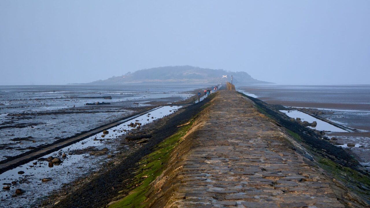
The Cramond Island walk is the only thing in this guide that can genuinely go wrong. A paved causeway runs about a mile out across the Drum Sands to a small uninhabited island in the Firth of Forth, flanked by a line of concrete pylons built to stop German torpedo boats, and it is one of the best short walks anywhere near Edinburgh. It is also submerged twice a day, and the coastguard is called out to people stranded on the island with tiresome regularity.
Almost nobody publishing on the Cramond Island walk answers the question people are actually asking, which is: can I cross today, and how do I know? Tide queries get sent to weather widgets and route queries get sent to walking apps, and neither tells you what the noticeboard at the causeway says. This guide covers the crossing rule, what happens if you get it wrong, what is on the island, the Roman village you walk from, and the wider Cramond half-day — including the parts that work when the tide is in.
At a Glance
- The rule: cross only within about two hours either side of low tide. The Cramond Heritage Trust describes the island as accessible usually only during four hours a day.
- The authority is the noticeboard at the landward end of the causeway, which posts the day’s safe crossing times. Read it. Do not substitute a tide app for it.
- If you are cut off, do not wade or swim. Call 999 and ask for the Coastguard, and wait on the island.
- The island is small: 7.7 hectares, about a third of a mile long, a mile offshore. An hour and a half on it is plenty.
- The concrete pylons beside the causeway are a Second World War anti-boat boom, built to keep torpedo boats and submarines away from the anchorage and Rosyth Dockyard.
- Cramond village has a Roman fort of about AD 142, built under Antoninus Pius to guard the eastern flank of the Antonine Wall.
- Getting there: Lothian service 32 is the route that serves Cramond. Alternatively take a Silverknowes bus — 16, 27, 29 or 37 — and walk the promenade.
- Lauriston Castle is nearby and its gardens are free all year; the house itself is by booked guided tour only.
- Allow a half day, and build it around the tide rather than around your morning.
The Crossing: How to Know If You Can Go Today
This is the whole article in one section, so it comes first.
The causeway is a paved path across tidal sand. It is exposed at low water and covered at high water, and the window in between is roughly two hours either side of low tide — the Cramond Heritage Trust puts the practical total at about four hours a day. The window is not the same every day and it is not the same length every day: spring tides shorten it, and weather can shorten it further.
- Read the noticeboard at the landward end of the causeway. It sets out the safe crossing times for the day. It is the source that matters, it is free, and it is standing there before you commit.
- Check before you leave the city as well. Walking guides and the RNLI publicise a text service — text CRAMOND to 81400 — that returns safe crossing times. Treat it as a useful backup and the board as the authority.
- Work backwards, not forwards. Decide the time you must be back on the mainland, subtract twenty-five minutes for the walk in and the same for the walk out, and that is how long you have on the island. Then take thirty minutes off it.
- Do not start a crossing in the second half of the window because you have driven a long way and do not want to waste the trip. That is the specific decision that produces most of the call-outs.
If you are cut off: stay on the island, go up onto higher ground, and phone 999 and ask for the Coastguard. Do not attempt to wade or swim back — the water over the sands runs fast, it is cold enough to cause cold-water shock for most of the year, and the causeway edges drop away. There is a refuge structure on the causeway itself, but the island is the safer place to wait. Waiting for the next low tide is uncomfortable; the alternative is worse.
The honest verdict: the rescue services here are patient and professional, and they are also called out to the same avoidable situation over and over. Getting stranded at Cramond is not an adventure story, it is a Tuesday for the local lifeboat crew. Read the board.
The Walk Itself
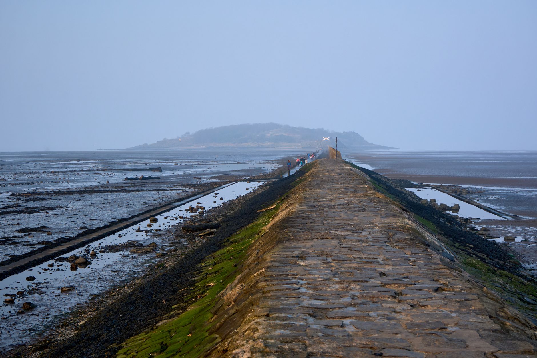
The causeway runs about a mile from the promenade at Cramond out to the island, and takes twenty to twenty-five minutes at an ordinary pace. It is flat, paved and easy underfoot, though the surface is wet, weeded and slippery in places where the tide has just left it, and the edges are seaweed-covered stone rather than a handrail.
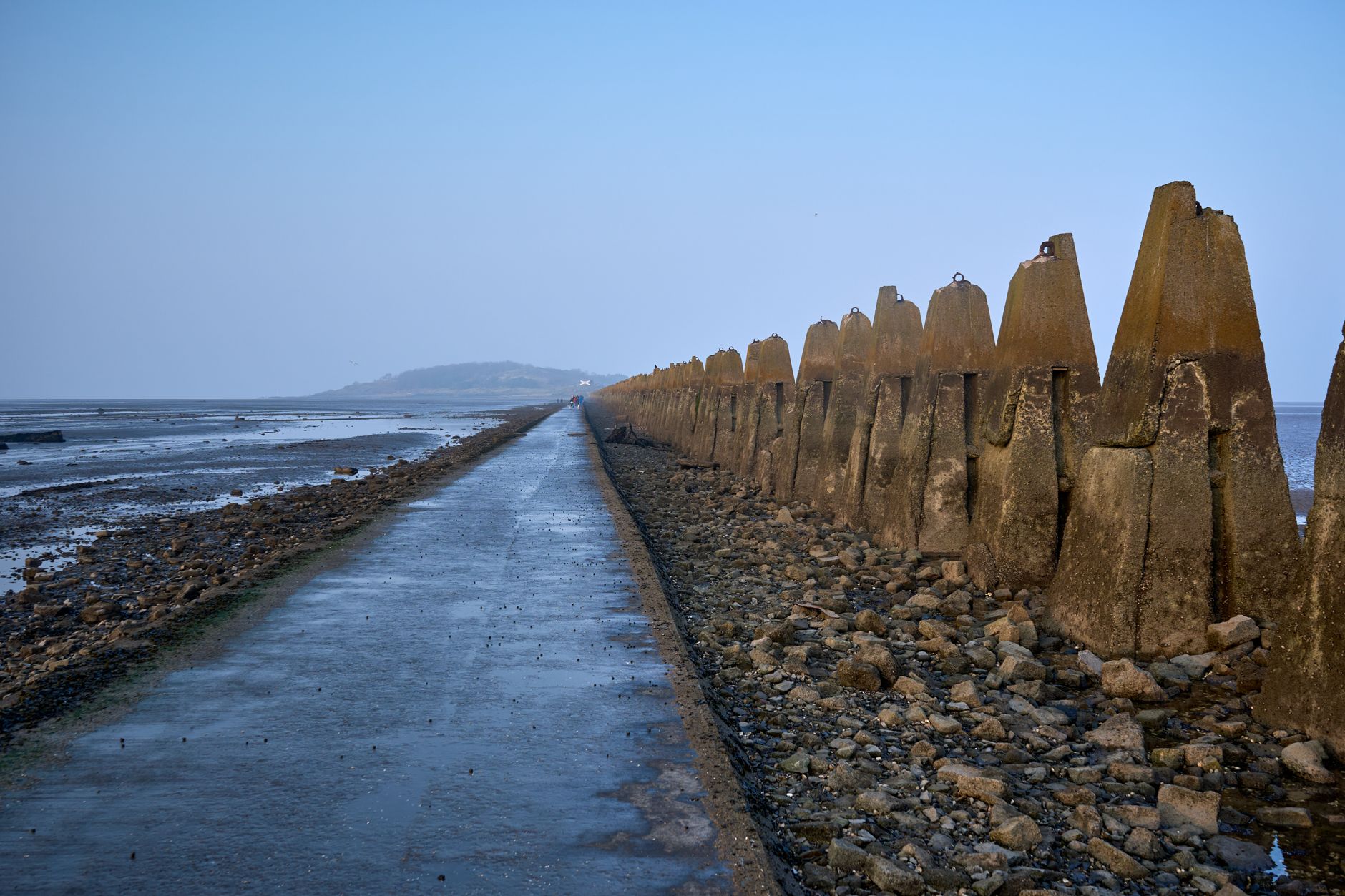
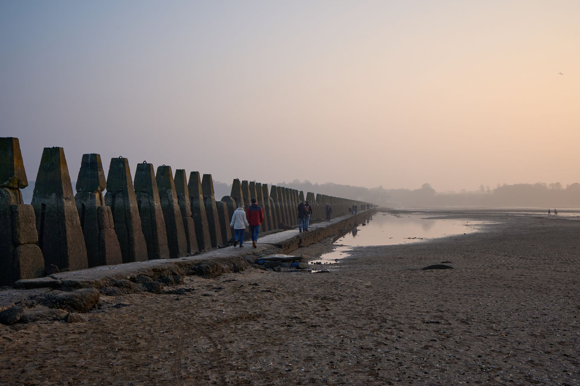
The line of angular concrete pylons running alongside is the reason most people photograph this walk. They were built during the Second World War as an anti-boat boom, closing the channel against torpedo boats and submarines that might threaten the Forth anchorage and the naval dockyard at Rosyth upstream. They march out to sea in perfect perspective, which is why the picture works from either direction.
| Stage | Distance / time | Notes |
|---|---|---|
| Cramond promenade to the causeway start | 2–3 minutes | The safe-crossing noticeboard is here |
| Causeway crossing | About 1 mile, 20–25 minutes | Flat and paved; slippery in patches |
| Circuit of the island | 45–60 minutes | Rough paths, WWII structures, no facilities |
| Return crossing | 20–25 minutes | Do not leave this to the last of the window |
| Total | 2 to 2.5 hours | Comfortably inside a four-hour window if you start on time |
What Is Actually on the Island
Cramond Island is 7.7 hectares — about 19 acres — and roughly a third of a mile long, lying about a mile offshore. It belongs to the Dalmeny Estate, owned by the Rosebery Estates Partnership. There is no café, no toilet, no shelter and no phone charging point, and there is no ferry: the causeway is the only way on and off.
What there is, is a very well preserved set of Second World War defences: emplacements for a 75mm gun, searchlight housings, the concrete stumps of barrack blocks, ammunition stores, engine rooms, an unidentified brick building, and the anchor points where anti-submarine nets were fixed. Structures are open, unfenced and unlit, with drops and rubble, which is worth knowing if you are bringing children.
Before the war it was farmed. The island had been in use since the 12th century, when it belonged to the Bishop of Dunkeld; the last farmer, Peter Hogg, died in 1904; the farmstead was still occupied into the 1930s; and sheep were kept out here as late as the 1960s.
The honest verdict: the island is the destination but the causeway is the experience. Forty-five minutes to an hour on the island covers everything worth seeing, and people who allow half a day for the island itself end up sitting on a concrete stump watching the tide. The walk out, the pylons and the view back to the Edinburgh skyline are what you came for.
Cramond Village and the Romans
The village you walk from is worth an hour in its own right, and it is the part that still works when the tide is in.
A Roman fort was built here around AD 142, under the emperor Antoninus Pius, to guard the eastern flank of the Antonine Wall. It held close to five hundred men across about six acres and had its own harbour at the mouth of the River Almond. It was abandoned after roughly fifteen years, then reoccupied between AD 208 and 211 during the campaigns of Septimius Severus. The outline of the fort is laid out beside the kirk, which is a more informative thing to look at than it sounds.
The best Roman thing from Cramond is not at Cramond. In 1997 a local boatman found the Cramond Lioness in the harbour mud — a sandstone sculpture of a lioness devouring a male figure, probably one of a pair from the tomb of a military commander, and one of the most ambitious pieces of Roman sculpture to survive in Scotland. It is now on display in the National Museum of Scotland, which is free and in the city centre.
Around the harbour: Cramond Kirk, founded in 1656, and Cramond Tower, a tower house probably built in the early 15th century as a manor of the Bishops of Dunkeld and converted into a private house in the 1980s — so admire it from the path rather than approaching it. Cramond itself was a separate place until it was incorporated into Edinburgh on 1 November 1920, the same year as Leith.
When the Tide Is In: the Plan B That Is Almost as Good
Half the people who travel to Cramond arrive outside the crossing window. That is fine, provided you know it in advance and bring a different plan.
- The Silverknowes promenade runs east along the shore from Cramond with a continuous view over the Firth of Forth to Fife. Flat, paved, and one of the best sea walks inside the city boundary.
- The River Almond walkway runs inland from the harbour towards Cramond Brig — a wooded riverside path past old mill sites, entirely sheltered, and unaffected by the tide.
- Lauriston Castle is a short distance inland. Its gardens are free to enter all year round; the castle itself opens at set times and is seen by guided tour, which must be booked online. Check tour prices on the venue’s own site before you go.
- The Roman fort site and the kirk at the top of the village — twenty minutes, free, and it makes sense of the whole place.
The honest verdict: Cramond without the island is still a good half-day, but it is a walk rather than an outing. If the island is the reason you are going and the tide is wrong, move the trip rather than the plan — this is the one place near Edinburgh where the timetable is set by something other than opening hours. For the city’s other coastal afternoon, Portobello beach works at any state of the tide.
Getting to Cramond
| How | Detail |
|---|---|
| Lothian service 32 | Runs Cramond/West Granton – Balerno; the service that lists Cramond. £2.40 single. |
| Silverknowes buses | Services 16, 27, 29 and 37 serve Silverknowes; walk west along the promenade to Cramond. |
| Contactless daily cap | £5.70 — worth it if you are also travelling in the city that day. |
| By bike | The shore route from the city is flat and largely traffic-free. |
| On foot from the centre | Not realistic as a there-and-back; take the bus one way at least. |
Whichever way you come, allow for the return. The last thing you want after mistiming a tide is to discover the bus is also a problem — our guide to Lothian buses and trams covers frequencies and ticketing, and cycling and bike hire in Edinburgh covers the coastal route out here, which is the nicest way to arrive.
Five Mistakes People Make Here
The failure modes at Cramond are unusually consistent, which is why they are worth listing.
- Using a tide table instead of the board. A tide app tells you when low water is. The board tells you when the causeway is safe, which is a shorter and differently shaped window, and it accounts for conditions on the day.
- Starting the crossing late in the window. If you arrive with an hour of the window left, the honest answer is that you do not have time for the island. Walk the promenade instead and come back another day.
- Assuming the return takes the same time as the outward leg. It rarely does. You will be tired, the light may be going, and the surface is worse once the water has started coming back over it.
- Chasing the sunset. Late light on the pylons is genuinely spectacular and it is also the single most common reason people lose track of the time out here.
- Trying to beat the water on the way back. Once the tide has closed over the causeway, the crossing is gone — the sands either side are soft, the channel runs fast, and wading is how a nuisance becomes an emergency. Turn round, go back up the island, and phone for the Coastguard.
The Silverknowes Promenade and Cramond Brig
Two walks run out of Cramond in opposite directions, and both are better than their obscurity suggests.
East along the shore, the Silverknowes promenade is a wide, flat, paved seafront path with the Firth of Forth on one side the whole way and Fife across the water. It is the most straightforwardly pleasant sea walk inside the Edinburgh boundary, it is completely tide-independent, and it connects to bus routes 16, 27, 29 and 37 at the Silverknowes end — which means you can walk one way and ride back.
Inland along the river, the River Almond walkway leaves the harbour and runs upstream through woodland towards Cramond Brig, past the remains of the mills that once worked this stretch of water. It is sheltered, shaded and a completely different landscape from the exposed foreshore two hundred metres behind you — the best option on a day when the wind off the Forth has made the promenade unpleasant.
The honest verdict: combine them. Bus to Silverknowes, walk the promenade west to Cramond, cross to the island if the tide allows, then take the river path inland before returning. That is a three-to-four hour outing that does not depend entirely on the tide going your way, which is the sensible way to plan a trip out here.
What to Take
- Shoes with grip. The causeway is wet stone and weed for part of its length, and the island paths are rough.
- A charged phone. It is your only way of calling for help, and there is nowhere to charge it out there.
- A windproof layer. The Firth of Forth is exposed and the island has no shelter; it is reliably several degrees colder than Princes Street.
- Water and something to eat. There are no facilities of any kind on the island.
- A watch, and the time you must be back written down. Sunsets and photographs are how people lose track.
Tide guidance, bus services and Lauriston Castle’s opening arrangements checked September 2026. Crossing times change daily — the noticeboard at the causeway is the authority, not this page.
Frequently Asked Questions
When can you walk to Cramond Island?
Within about two hours either side of low tide — roughly four hours a day in total, though the window varies and can be shorter. The safe crossing times for the day are posted on a noticeboard at the landward end of the causeway, and that board is the authority. Check it before you set out along the path.
What happens if you get stranded on Cramond Island?
Stay on the island, move to higher ground, and call 999 and ask for the Coastguard. Do not try to wade or swim back: the water over the sands moves quickly, it is cold enough to cause cold-water shock for most of the year, and the causeway edges drop away. Rescue call-outs here are frequent and entirely avoidable.
How long does the Cramond Island walk take?
About twenty to twenty-five minutes each way along the mile-long causeway, plus forty-five minutes to an hour to walk the island. Two to two and a half hours in total, which fits comfortably inside a four-hour crossing window provided you start at the beginning of it rather than the end.
What are the concrete pylons at Cramond?
They are a Second World War anti-boat boom, built along the causeway to stop torpedo boats and submarines reaching the Forth anchorage and the naval dockyard at Rosyth. They are the most photographed feature of the walk.
How do you get to Cramond from Edinburgh city centre?
Lothian service 32 runs Cramond/West Granton to Balerno and is the route that lists Cramond. Alternatively take a Silverknowes bus — 16, 27, 29 or 37 — and walk west along the promenade. A single is £2.40 and the contactless daily cap is £5.70.
Is there anything on Cramond Island?
Second World War defences: emplacements for a 75mm gun, searchlight housings, barrack stumps, ammunition stores, engine rooms and anti-submarine net anchor points. There is no café, toilet, shelter or ferry. The island is 7.7 hectares, was farmed until the 1930s, and had sheep on it as late as the 1960s.
What is there to do at Cramond if the tide is in?
Walk the Silverknowes promenade east along the Firth of Forth, follow the River Almond walkway inland towards Cramond Brig, look at the Roman fort site beside the kirk, or visit Lauriston Castle, whose gardens are free to enter all year round. The castle itself is by booked guided tour.
Was there really a Roman fort at Cramond?
Yes — built around AD 142 under Antoninus Pius to guard the eastern flank of the Antonine Wall, holding close to five hundred men across about six acres with its own harbour. It was abandoned after roughly fifteen years and reoccupied between AD 208 and 211 under Septimius Severus. The Cramond Lioness, found in the harbour mud in 1997, is now in the National Museum of Scotland.
Is the Cramond Island walk suitable for children?
The causeway is flat and easy, but it is a mile each way with no shelter and no facilities, and the wartime structures on the island are open, unfenced and unlit, with drops and loose rubble. It works well for confident walkers of about eight upwards; younger children will need the timings built around them, with a large margin on the return.
Cramond is one of the outlying districts in our complete area-by-area guide to Edinburgh’s neighbourhoods. Along the coast to the east lie Leith and The Shore and Portobello beach; inland, the river route connects to the Water of Leith walkway. For more walks like this one, see outdoor activities and adventures in Edinburgh.